Djurgårdsbrunn Canal
Stockholm, Sweden
Discover Djurgårdsbrunn Canal in Stockholm, Sweden. Explore its rich history, the royal vision behind its creation, and its role today as a beloved recreational oasis.
Overview
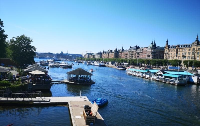
Nestled within the verdant expanse of Djurgården in Stockholm, Sweden, the Djurgårdsbrunn Canal offers a tranquil escape and a captivating journey through history. This scenic waterway, known locally as Djurgårdsbrunnskanalen, carves a serene path, separating the island of Djurgården from the northern mainland. It stretches for approximately one kilometer, connecting Lilla Värtan in the east to Djurgårdsbrunnsviken in the west. Today, it stands as a cherished recreational haven, inviting locals and visitors alike to enjoy its oak-lined paths, picturesque bridges, and the gentle flow of its waters.
More than just a hydrological feature, the canal is an integral part of the Royal National City Park, a unique urban green space. Its banks are popular for leisurely strolls, invigorating jogs, and cycling, while the canal itself bustles with paddle boats, kayaks, and sightseeing vessels during warmer months. The Djurgårdsbrunn Canal is a testament to a royal vision that blended practicality with an appreciation for natural beauty, creating a timeless landscape that continues to enchant.
History & Cultural Background
The story of the Djurgårdsbrunn Canal begins in the early 19th century, initiated by King Karl XIV Johan, who reigned from 1818 to 1844. Construction commenced in 1825 and was a considerable undertaking, finally reaching completion in 1834 after nearly a decade of work. The King's motivations were multifaceted, extending beyond mere aesthetics to encompass public health and urban development.
Historically, Djurgården was indeed an island, but over centuries, due to a phenomenon known as post-glacial rebound (where land rises after being compressed by glaciers), the waterway separating it from the mainland had gradually disappeared, turning Djurgården into a peninsula. This resulted in a swampy area, Isbladsträsket, which became a breeding ground for disease, including malaria. King Karl XIV Johan sought to drain this wetland, protecting his family's health at nearby Rosendal Palace and beautifying the royal park. The canal, therefore, served to re-establish Djurgården's island status, a significant hydrological undertaking for its time.
Beyond drainage, the canal was designed to facilitate transport, allowing smaller ships laden with supplies to reach central Stockholm more easily. However, an equally, if not more, important aspect of its creation was the King's desire to enhance the attractiveness of Djurgården as a royal park and recreational area. This included thinning vegetation, improving drainage, and planting noble deciduous trees, shaping the pastoral landscape visible today.
What Makes It Special
What sets the Djurgårdsbrunn Canal apart is its harmonious blend of historical significance, ecological importance, and its enduring role as a public amenity. It is not merely a channel for water but a living museum of landscape architecture and royal ambition. The canal's strategic creation re-engineered the geography of Djurgården, transforming a formerly swampy area into a picturesque and healthy environment.
The meticulous planning behind its construction, including the planting of tree-lined paths and the integration of its romantic curves into the park, highlights an early understanding of urban green spaces and their impact on well-being. This foresight has ensured its continued relevance as a beloved recreational corridor, providing a crucial green lung in the heart of Stockholm. Furthermore, the canal's relatively modest dimensions – 9.5 meters wide and 2.1 meters deep – allow for an intimate interaction with the water, whether from its banks or from a small boat, fostering a sense of peaceful immersion rarely found in a capital city.
Stories, Fun Facts & Local Details
One popular, though incorrect, local legend suggests the canal was dug to keep deer and other game within the royal hunting grounds of Djurgården. In reality, the royal hunting park had fallen out of use about 50 years before the canal's construction, and the primary reasons were much more practical and aesthetic.
The name 'Djurgårdsbrunn' itself offers a glimpse into the area's past, referring to a mineral spring discovered in 1690. This spring led to the establishment of a health resort in the 1740s, where people would 'drink from the well' in hopes of improving their health. While the resort eventually faded, the name, evoking images of healing waters, persisted.
Two charming bridges span the canal: Djurgårdsbrunnsbron and Lilla Sjötullsbron. Interestingly, Djurgårdsbrunnsbron was once Stockholm's only remaining swing bridge, a common type in the 19th century, though it has been permanently closed since 1966. The paths along both sides of the canal are a popular 5-kilometer loop, especially cherished by Stockholmers seeking solace and exercise. In spring, these paths can become quite busy with people eager to embrace the warmer weather.
Visitor Perspective
For the curious traveler, the Djurgårdsbrunn Canal offers a multifaceted experience. It’s an ideal destination for a leisurely walk or bike ride, allowing visitors to soak in the picturesque scenery and the calming presence of the water. The tree-lined avenues provide shade and beauty throughout the seasons, with autumn being particularly stunning as the foliage transforms into vibrant hues.
Many choose to explore the canal by water, renting kayaks or paddle boats, or joining one of the sightseeing tours that navigate its length, offering unique perspectives of Djurgården's lush landscapes and historic buildings. The canal's accessibility, being stroller-friendly and near public transport, makes it an inviting spot for families and individuals alike. Whether you're seeking a peaceful retreat, a dose of history, or an active outdoor experience, the Djurgårdsbrunn Canal provides a perfect backdrop within the heart of Stockholm's royal park.
Coordinates: 18.13889, 59.32806
View on Google MapsTraveler Stories
Discover memorable experiences shared by travelers who have visited this place.
No traveler stories yet.
Be the first traveler to share what made this place memorable.
Tour
By
Spot
Discover amazing places around the world. Your journey starts here.
Explore
© 2026 TourBySpot. All rights reserved.